Project Information
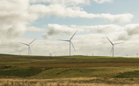
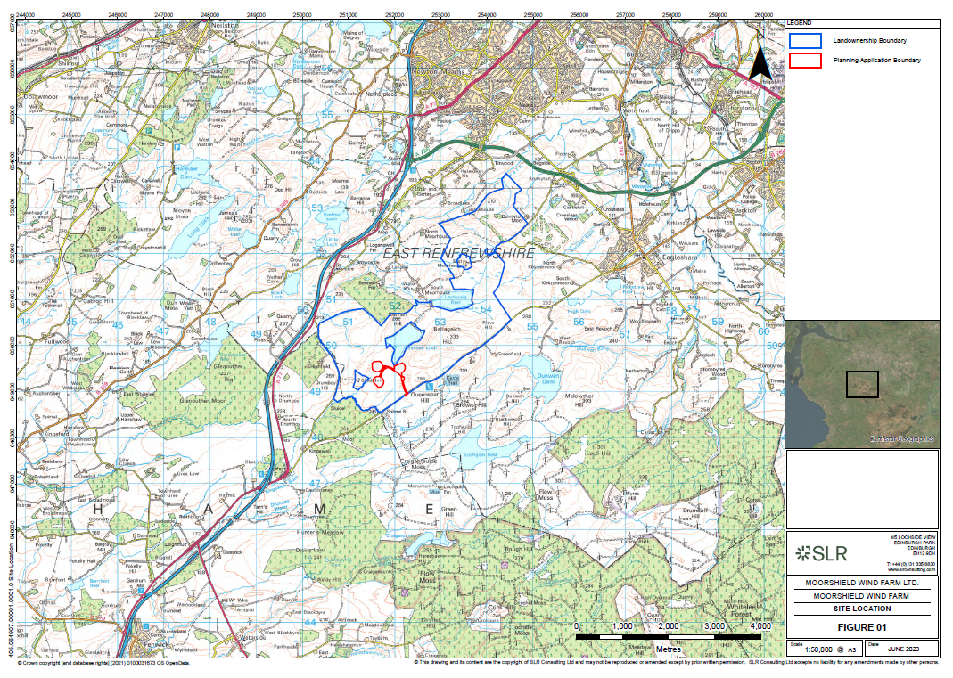
The consented wind turbines will be sited on land south west of Bennan Loch, around 1km east of the M77 and less than 1km west of the operational Whitelee wind farm in East Renfrewshire.
Project Description
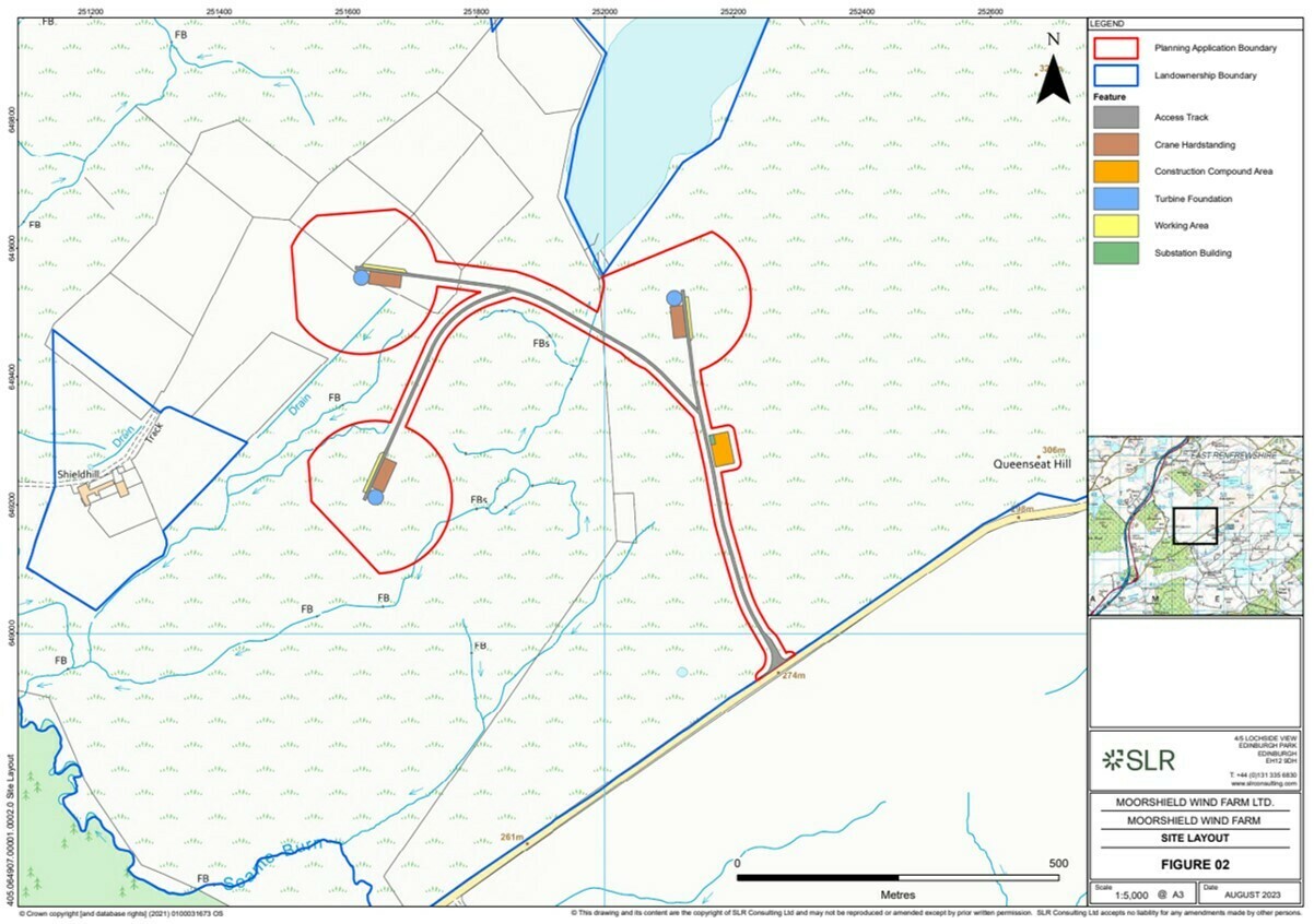
The development will comprise the following principal components:
- 3 wind turbines, each with a maximum blade tip height of up to 149.9m
- Turbine foundations for each wind turbine
- Hard standings adjacent to each wind turbine, including crane pads
- Underground electrical cabling
- A substation control building and compound
- Access tracks, including one new watercourse crossing and new site entrance from the B674 Moor Road
- A temporary construction compound and laydown area
The layout of the development is shown below.
The development will have an anticipated installed capacity of approximately 15 MW and the wind turbines are estimated to produce approximately 50,000 megawatt hours (MWh) of electricity annually. This is sufficient to meet the needs of around 14,250 average UK homes*.
Moorshield Wind Farm is expected to displace approximately 21,000 tonnes of carbon dioxide per year*.
The project also has a near term grid connection date which means that it will contribute to the Scottish Government’s target for a minimum of 20 GW of onshore wind by 2030.
A revised planning application for Moorshield Wind Farm was submitted to East Renfrewshire Council and validated on 14/09/2023, with planning reference 2023/0542/TP which was granted on 25/09/2024.
All of the application documents can be viewed on the East Renfrewshire Council Planning Portal, and are also available below:
Appendix 2 1 Landscape and Visual Appraisal
Appendix 2 2 Peat Probing Summary Report
Appendix 2 3 Hydrology Assessment
Appendix 2 5 Biodiversity and Natural Heritage Report Part 1 of 4
Appendix 2 5 Biodiversity and Natural Heritage Report Part 2 of 4
Appendix 2 5 Biodiversity and Natural Heritage Report Part 3 of 4
Appendix 2 5 Biodiversity and Natural Heritage Report Part 4 of 4
Appendix 2 6 Aviation Assessment
Appendix 2 7 Shadow Flicker Assessment
Appendix 2 8 Transport Drawings
Appendix 4 Peat Management Plan
Appendix 5 Noise Planning Update
Appendix 7 Noise Planning Update
Appendix 9 Sanquhar II Community Wind Farm Decision
Appendix 10 Clauchrie Wind Farm Decision
Figure 4 Typical Turbine Foundation
Figure 5 Typical Section Through Track
Figure 6 Typical Substation Elevations
Figure 7 Typical Crane Hardstanding
Figure 1 3 LVA ZTV Blade Tip Large Format
Figure 1 5 LVA ZTV Hub Height Large Format
Figure 1 6 LVIA Detailed Study Area
Figure 1 7 SNH Landscape Character Types
Figure 1 8 Local Landscape Character Types
Figure 1 9 Local Landscape Capacity
Figure 1 11 Landscape Planning Designations and Viewpoint Locations
Figure 1 12 Recreational and Transport Routes
Figure 1 13 Residential Properties Settlements and PROW
Figure 1 14 Cumulative Baseline
Figure 1 15 Cumulative Baseline Detailed Study Area
Figure 1 16 Cumulative ZTV1 Existing Wind Farms
Figure 1 17 Cumulative ZTV2 Consented Wind Farms
Figure 1 18 Cumulative ZTV3 Application Wind Farms
Figure 1 19 Cumulative ZTV4 Detailed Study Area
Figure 1 20 Viewpoint 1 Kingswell Road near Highfield
Figure 1 21 Viewpoint 2 Greenfield Hill Mast
Figure 1 22 Viewpoint 3 Threap Knowe
Figure 1 23 Viewpoint 4 Swan Cottages
Figure 1 24 Viewpoint 5 Mid Floak M77
Figure 1 25 Viewpoint 6 Bonnyton Golf Club Car Park
Figure 1 26 Viewpoint 7 Eastwood Golf Club
Figure 1 27 Viewpoint 8 M77 East of Stewarton
Figure 1 28 Viewpoint 9 Neilston Pad
ERC1 Report of Handling for previous application
ERC2 Decision Notice for previous application
*Calculation correct as of December 2022 based on RenewableUK methodology, utilising the most recent household consumption and non-renewable emissions statistics from the Department of Business, Energy and Industrial Strategy (BEIS) (https://www.renewableuk.com/page/UKWEDExplained)”